In nearly every case, “historical geodata” means a paper map. Digitizing that map gives us an image of a paper map. While an image can be useful, historical maps turned into actionable data are much more useful. Moving geodata from paper to electronic data can be complicated and involve many actions, including:
- Describe the map accurately, preferably using standard terms
- Digitize the map
- Georectify the digitized image (associate points in the image with their geocoordinates, for example, so that the image can be positioned on OpenStreetmap or Google Maps exactly where it belongs)
- Extract image features—such as polygons, text, or contour lines—as digital layers
From November 5-7, 2014, I attended a meeting of 54 people from three continents at the New York Public Library called Moving Historical Geodata to the Web. This meeting, including expenses for attendees, was funded by the Alfred P. Sloan Foundation. We were the only archives and the only Canadian institution represented.
This was not the kind of meeting where participants give presentations and then go home. It was a mix of presentations, discussions and collaborative brainstorming designed to produce long-term working relationships, projects and infrastructure.
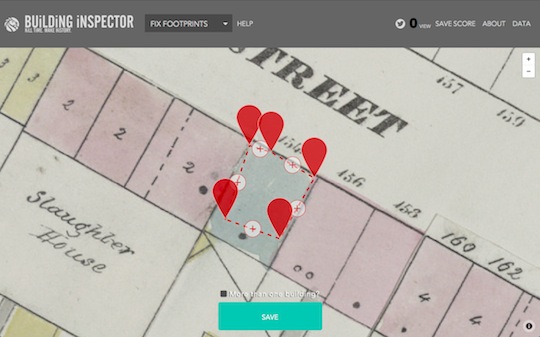
Our host, Matt Knutzen, Geospatial Librarian and Curator for NYPL, explained the inspiration for this meeting. In 2001, NYPL started digitizing maps and has since digitized thousands. They always wanted them to be more than just images, and to be usable by the public. NYPL Labs has worked with Topomancy LLC to create Map Warper, an award-winning web application which allows anyone to georectify images of maps and extract some features. NYPL Labs also created Building Inspector, an application which allows the public to contribute “bite-sized” quality inspection and correction of map features which have been extracted by machine. Realizing that other institutions also wanted to make their maps actionable in some way, they organized this meeting to organize the community.
Participants work as developers, librarians, researchers, institutional administrators, conservators, educators, artists, geospatial specialists, visualization and public access professionals, bringing diverse perspectives to the group. Lightning talks showed us some of the projects they were involved in and gave an indication of where there might be overlap and gaps.
Here’s a sample of the projects mentioned in these talks:
The National Library of Scotland has, among other things:
- over 91,000 digitized maps online, with hundreds georeferenced
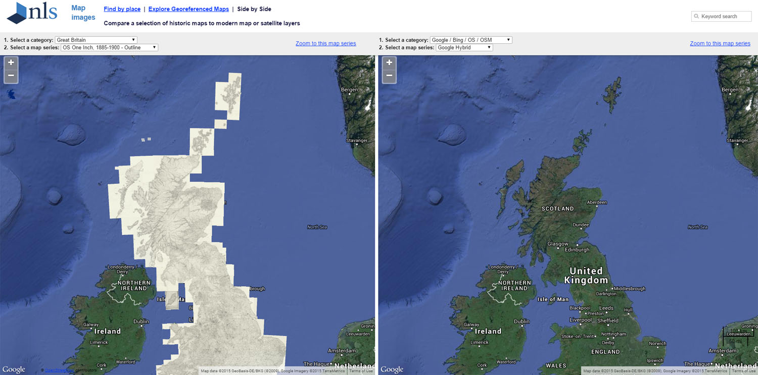
- a viewer which allows comparison of maps side by side
- Visualizing Urban Geographies, which provides mapping tools for historians
The University of Virginia created Map Scholar, an online application that allows georeferencing, annotation, image processing and curation of geospatial data.
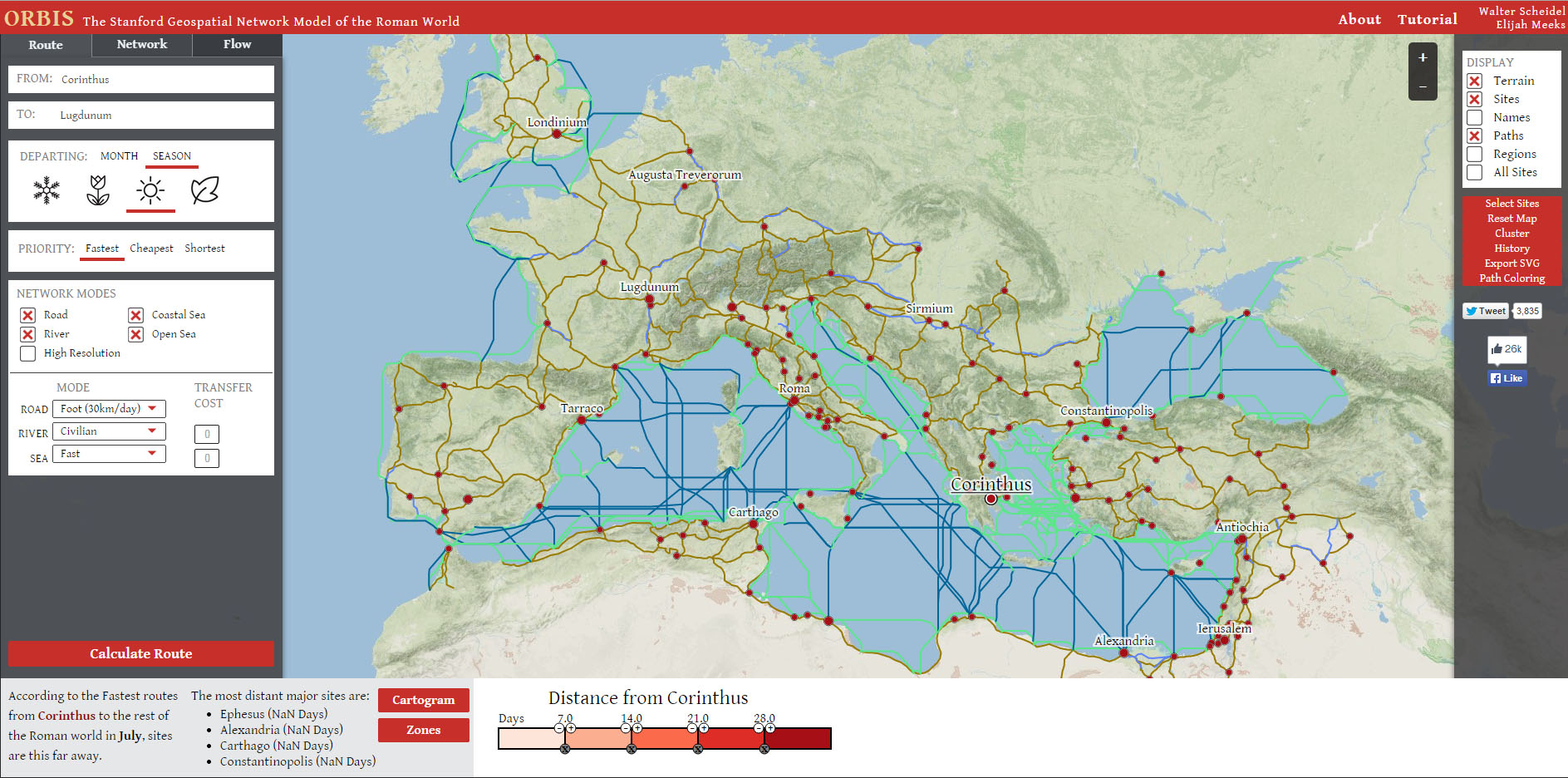
Stanford University developed Orbis, an interactive mapping application of transportation (“the circulatory system of human movement”) in the Roman Empire. It would be wonderful to create an Orbis of other times and places.
Shift (creators of Historypin), based in London, created Mapping Emotions in Victorian London, a crowd-sourced project to annotate a map with emotions from Victorian fiction.
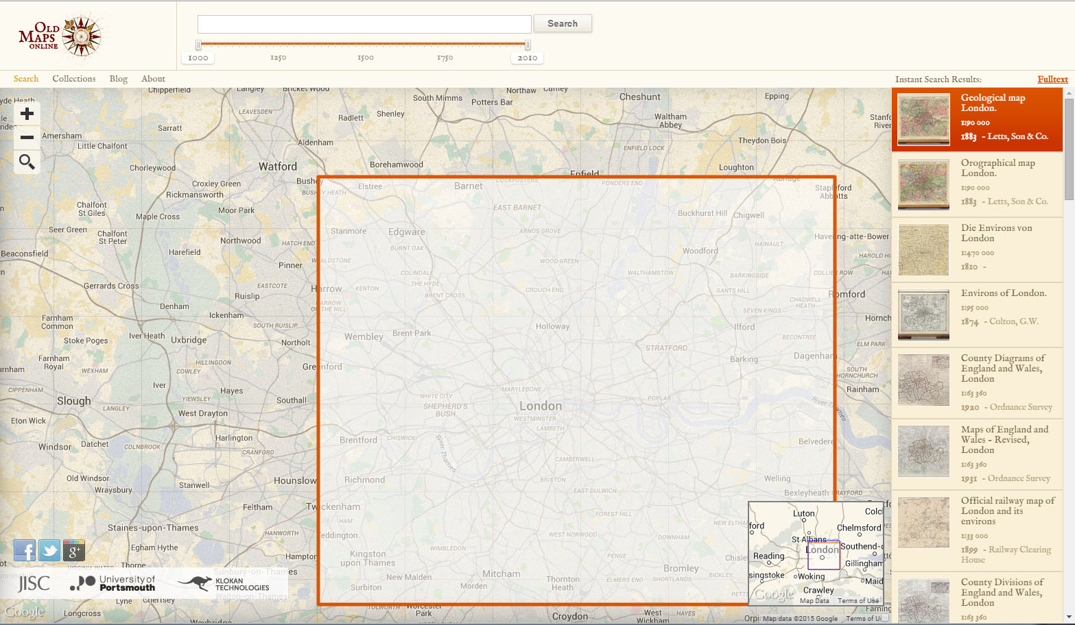
The University of Portsmouth and the Great Britain Historical GIS Project have created Old Maps Online with technological development from Klokan Technologies. Scans of maps in repositories around the world can be found and viewed.
OpenStreetMap has a new OpenHistoricalMap project to make georectified historical maps available in different time layers.
MIT Libraries, Princeton University and Stanford University have collaborated on GeoBlacklight, a project which improves searching and sharing of structured geospatial data and is also useful with scanned map images.
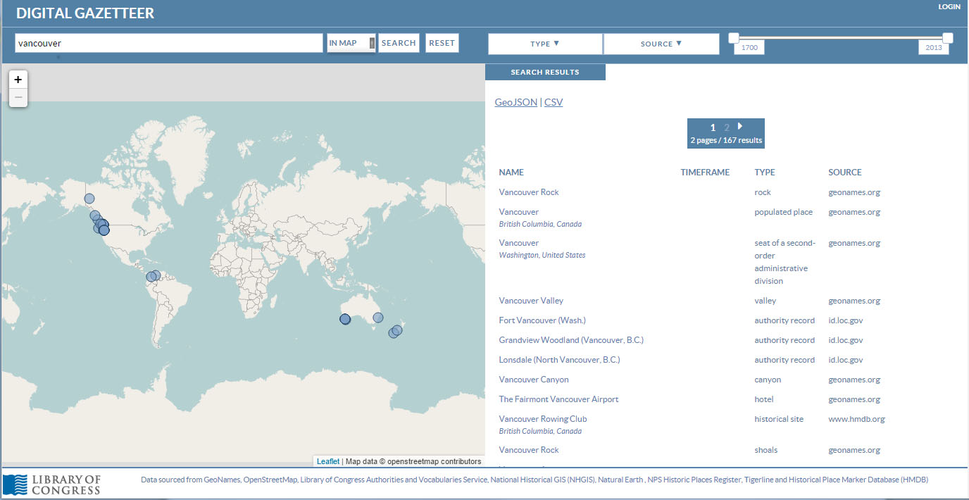
The Library of Congress, working with Topomancy LLC, has created a digital gazetteer (geographical dictionary), drawing on information from over 100 different databases.
Wikimedia Finland is starting to make archival maps available through Wikimaps and would like to contribute to the OpenHistoricalMap project and work toward a seamless online historical experience which would include georeferencing and a gazetteer.
Having reviewed the current state of the relevant technology, we broke into groups to discuss issues. This gave us some useful ideas, including:
- One big vision, an ambitious common goal, roughly summarized as “the sum total of human geography, rasterized, vectorized, made available to everyone, everywhere for free”.
- We also recognized that there are many different types of users of geographic data (not just academic researchers), so it needs to be available in different, flexible ways.
- Tools to automatically extract information from scans are either rudimentary or do not exist: much of this work is being done by hand.
- It is important to continue to preserve the original paper map and to build digital preservation into our work.
- It would be useful to adapt Tim Berners-Lee’s 5-star system for publishing data to create a similar system for publishing geodata
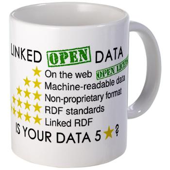
Mug available in W3C shop on Café Press.
We also realized we need to find more ways to collaborate on the large projects. The next step was for everyone to identify people they could collaborate with, and discuss how that could happen. Many specific plans were made for collaboration on digitization, software development on Github, gazetteer development, and more.
Finally, each participant made a pitch for a specific project or idea, large or small, which could be worked on, and participants voted with stickers on which ones they thought were feasible, which they thought would have the greatest impact and which they would commit to working on. Top-voted ideas are here. A sample of these ideas are:
- United (States|Kingdom) of (Sanborn|Goad). Sanborn Fire Insurance maps exist of the entire United States, held by various institutions; some other countries are shown in Goad’s maps. We should locate them, describe and scan them all.
- Map CAPTCHA. Create a CAPTCHA-like way for the public to contribute to verifying map data.
- Build a reliable and automated feature extractor.
- Contribute data to OpenHistoricalMaps.
This meeting was a great success, as it brought together a community of interest and created several plans of action. We are pleased to be able to contribute to some of these initiatives.
Historical geodata is a valuable resource and we have already digitized and made available some key maps in our holdings. In 2015, we intend to make more historical geodata available, and make it useful in different ways. We will be announcing these projects as they are completed.
