Earlier this year, the City upgraded its online mapping tool, VanMap. Replacing the Legacy VanMap, the new VanMap application and its Property Viewer app offers quick access to information useful for building and neighbourhood history research. The Archives’ 1912 Goad’s layer is still available, but to help you find it on the new platform, we’d like to introduce you to the site and walk you through it.
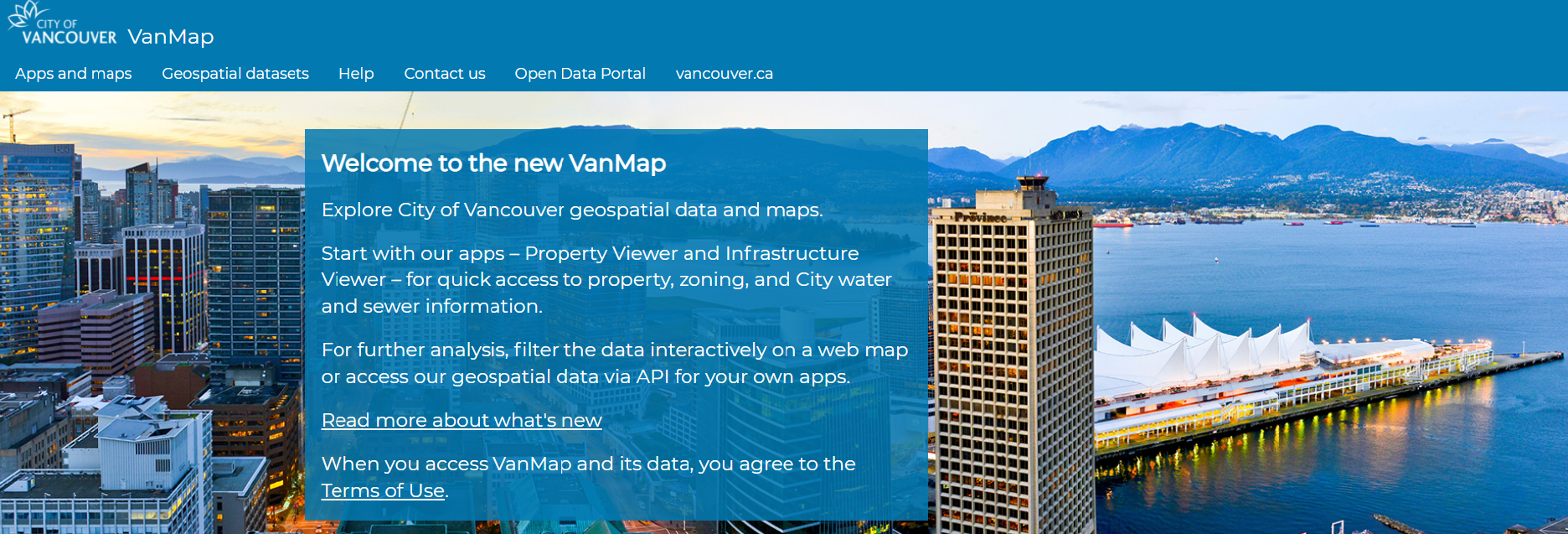
Built on ArcGIS software, various maps and geospatial datasets have been integrated into the new VanMap and are used for a range of tasks both by City employees and members of the public. Some researchers might have already come across the new VanMap, as the development and testing of the site has been phased in over the last couple of years.
In 2015, the Archives collaborated with the City’s GIS and Open Data Teams to launch the 1912 Goad’s fire insurance map layer on VanMap. Fire insurance maps and atlases frequently are utilized in property history research because they depict building footprints, building material and other details, legal land description, and lot features. The 1912 Goad’s map is a “snapshot” of the city for that year and also includes information such as historic shorelines, streams, streetcar lines, former street names, and civic addresses. More detailed information about the Goad’s map and how it can be used for house history research can be found on our blog.
The original 1912 Goad’s fire insurance map consists of a series of plates assembled as an atlas. The plates were digitized, cropped and georectified and then stitched together into one larger area map of Vancouver to create the VanMap layer. While the Archives also offers digital access to each plate from our online database, VanMap allows users to search properties by address or GIS coordinates and display them as they looked in 1912.
To start using the Property Viewer, click on “Open App” from the VanMap Property Viewer on the Apps and Maps page.
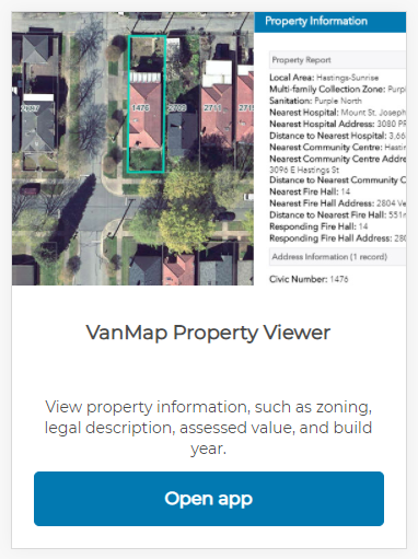
You will be taken to the main Property Viewer screen.
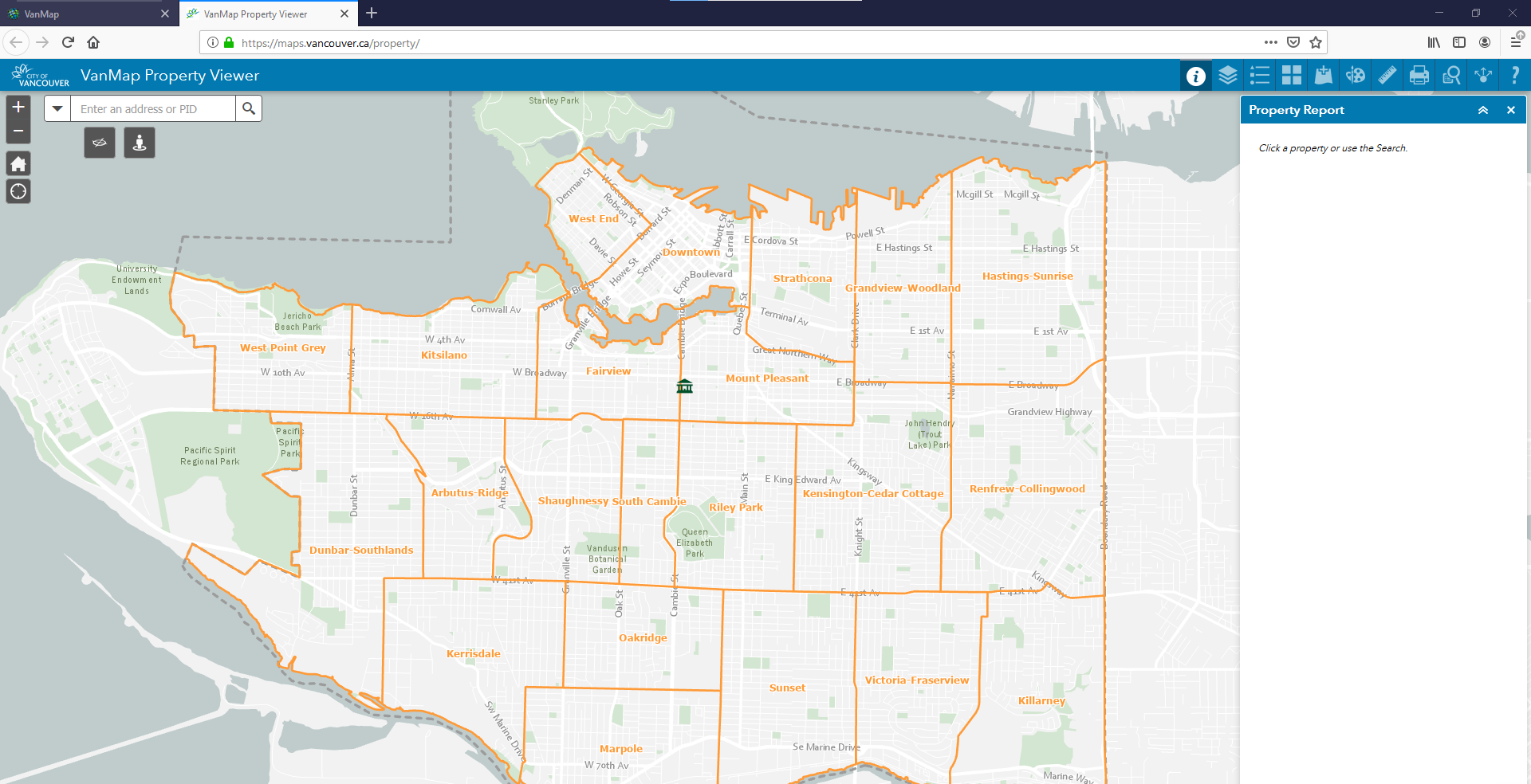
First, some basic property information.
Entering the address for a particular property will bring up a Property Report for that site including the legal land description, the year built, as well as the “big improvement year” for any major construction or renovation.
Here is an example showing a search for a heritage building in Chinatown located at 104-108 East Pender.
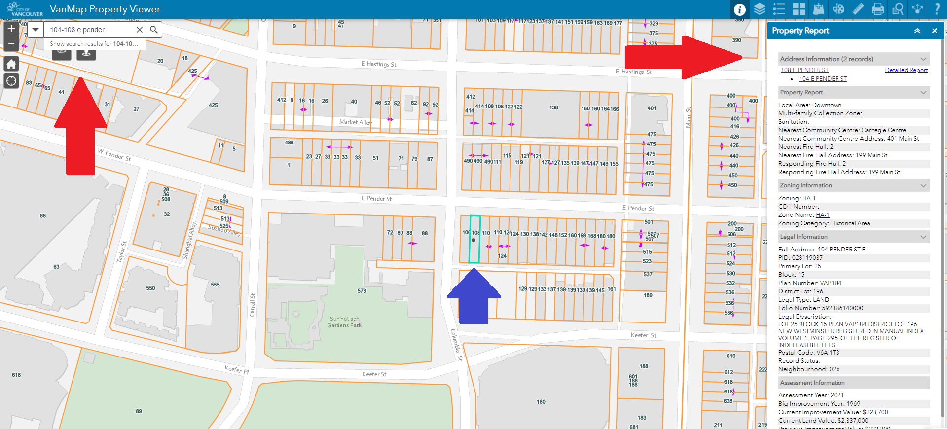
The address has been entered in the search menu (top left) and the search executed by clicking on the magnifying glass or using the enter key. The map has then zoomed in on that area and highlighted the particular lot (centre), and the property report has been generated (far right).
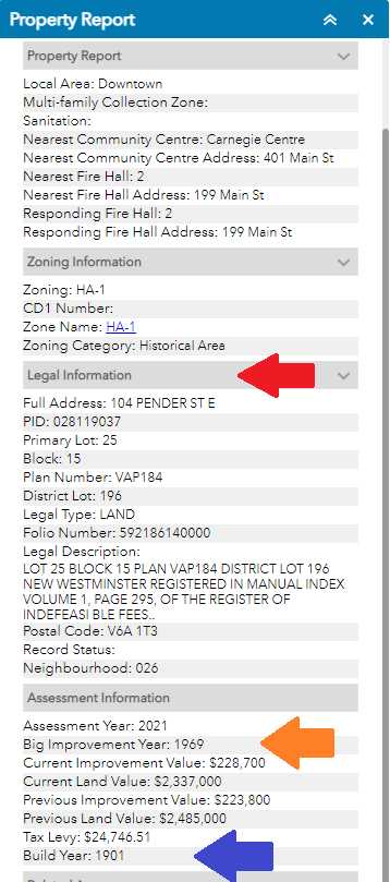
Here’s a close up of the property report showing the legal information section (top arrow), improvement year (middle arrow) and year built (bottom arrow).
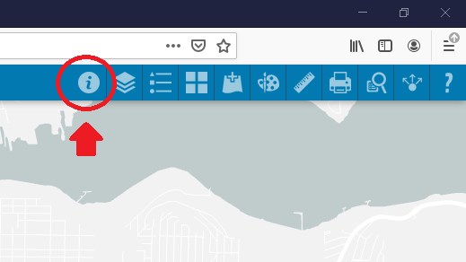
If the report is ever closed, you can get back to it by clicking the “property report” icon from the menu bar at the top right side of the app, as shown here:
Next, let’s add the 1912 Goad’s map.
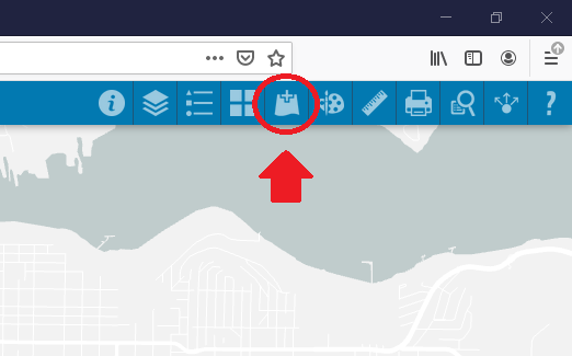
The 1912 fire insurance map is available as its own data layer. Select the “Add Data” icon to bring up layer options.
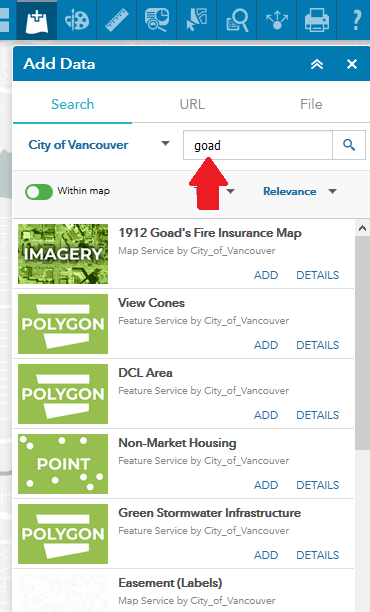
If the Goad’s layer is not listed as a layer in the menu, you can search for it by typing “Goad” in the search bar. Click the magnifying glass to the right or use your enter key to execute the search.
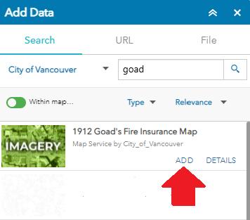
Select “ADD” to bring up the layer.
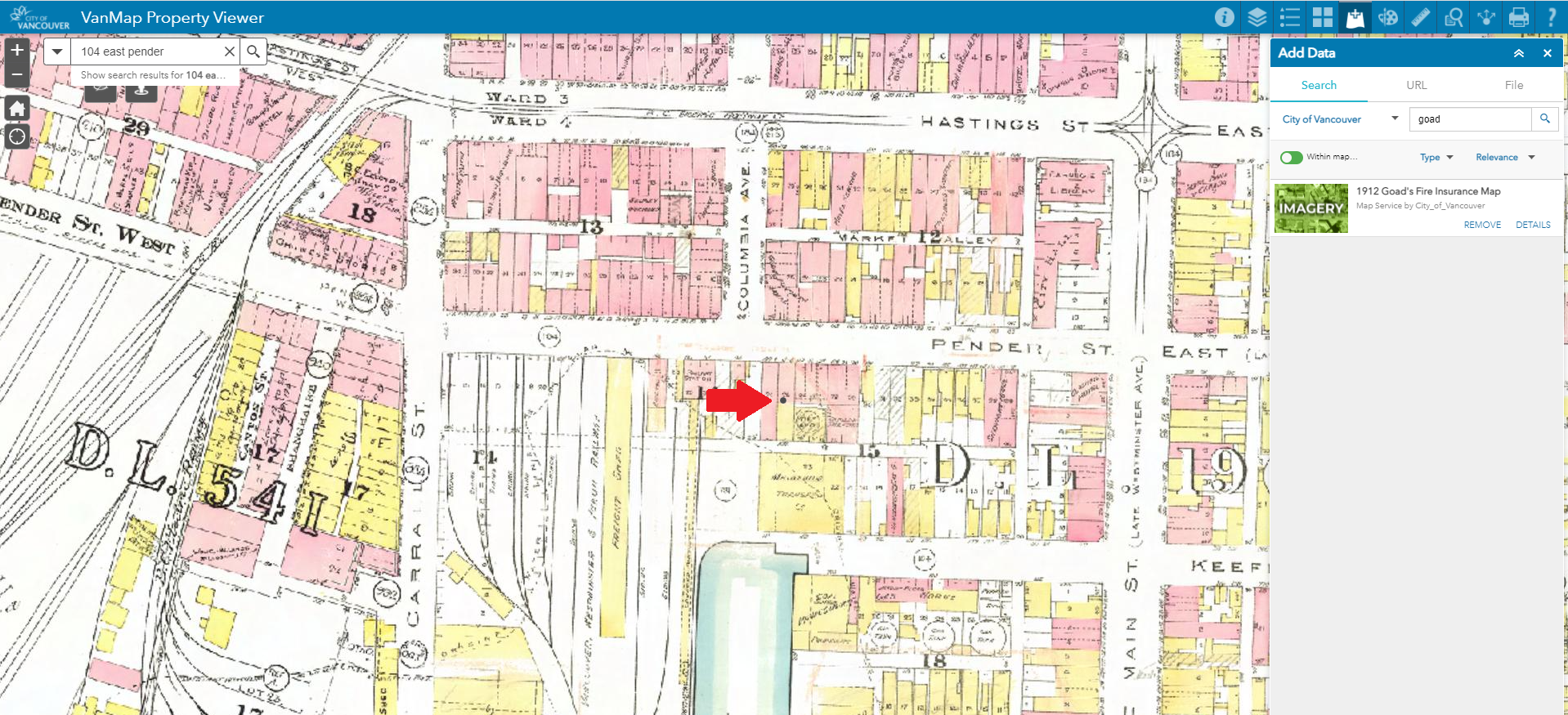
Now, the 1912 fire insurance layer appears and the property on East Pender is still marked on the map, identified by a small black dot:
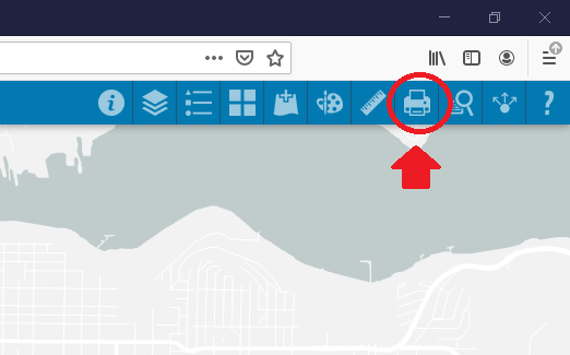
VanMap also allows users to save a copy of their view by selecting the “Print” icon. Different file formats can be selected, such as PDF or JPEG. Choose the print icon from the toolbar.
There are many more maps and datasets, as well as other menu options, but this introduction provides Archives’ users with basic instruction for locating property information and viewing the 1912 fire insurance map.
Happy researching everyone!
